Historical Maps
We’re excited to share that seven different historical maps of McNab/Braeside are now available for purchase! Each map showcases a unique piece of our Township’s rich past.
Size: Approximately 35” x 46”
Cost: $10 + HST
$2.50 from every sale will be donated to the Arnprior & McNab/Braeside Archives
The maps will be on display in the Council Chambers and can be viewed prior to purchase.
Where to buy:
Township Office (2473 Russett Drive) Accepting Cash and Debit
|
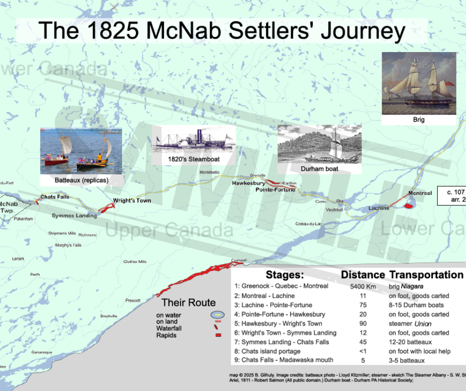
Map 1
1825 – The Settlers’ Journey
Created for this commemoration, Map 1 shows the route traveled by the 1825 McNab settlers after their arrival in Montreal and their means of transport in Canada. Most of the travel was by water and included an overnight trip on the first-ever steamboat on the Ottawa, the Union. Many place names shown changed after 1825.
|
|
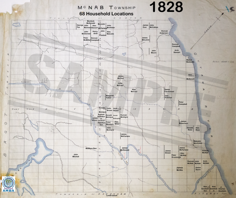
Map 2
1828 – Settlers’ First Locations
These locations were reported to the government by Arch. McNab as Land Agent. A “location ticket” gave the holder exclusive right for seven years to settle and clear a lot. Only once sufficient land was cleared could the settler apply to own the land. Often, a settler family would find its first or subsequent location unworkable, abandon it, and move on to try again. Map 2 plots the 1828 locations on an early copy of the 1824 survey.
|
|
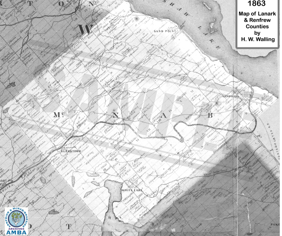
Map 3
1863 – The First Commercial Map
H. W. Walling produced many maps of counties in the Province of Canada just prior to Confederation. Map 3 is an enhanced enlargement of a small section of his 1863 wall map of the United Counties of Lanark and Renfrew. It shows the owners of houses and businesses, rather than of township lots.
|
|
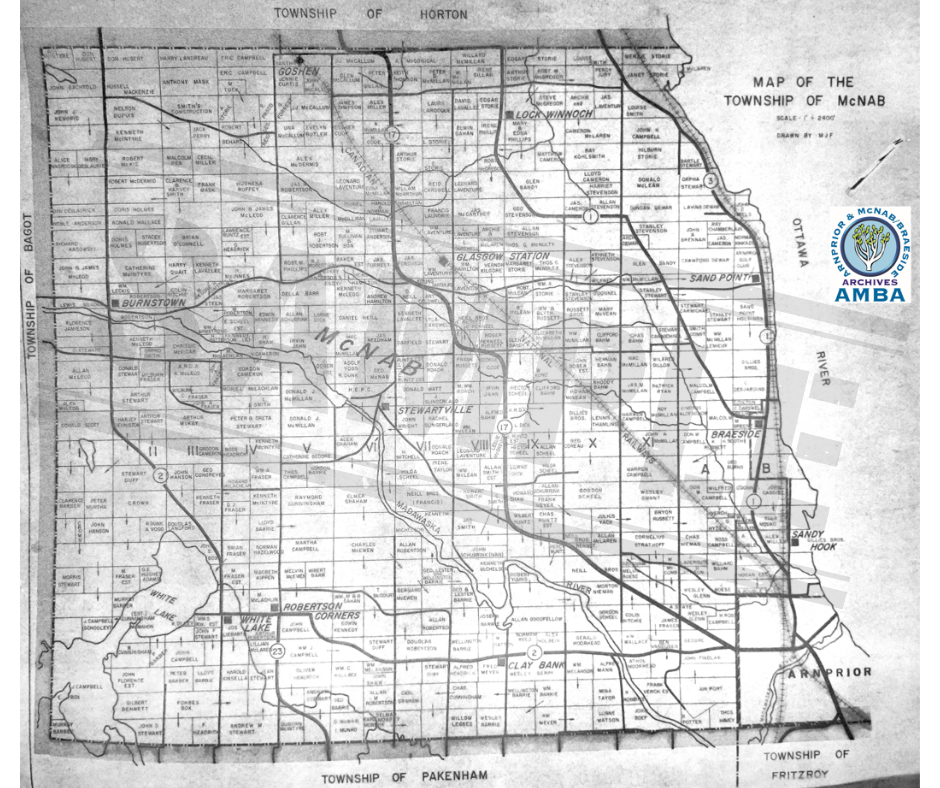
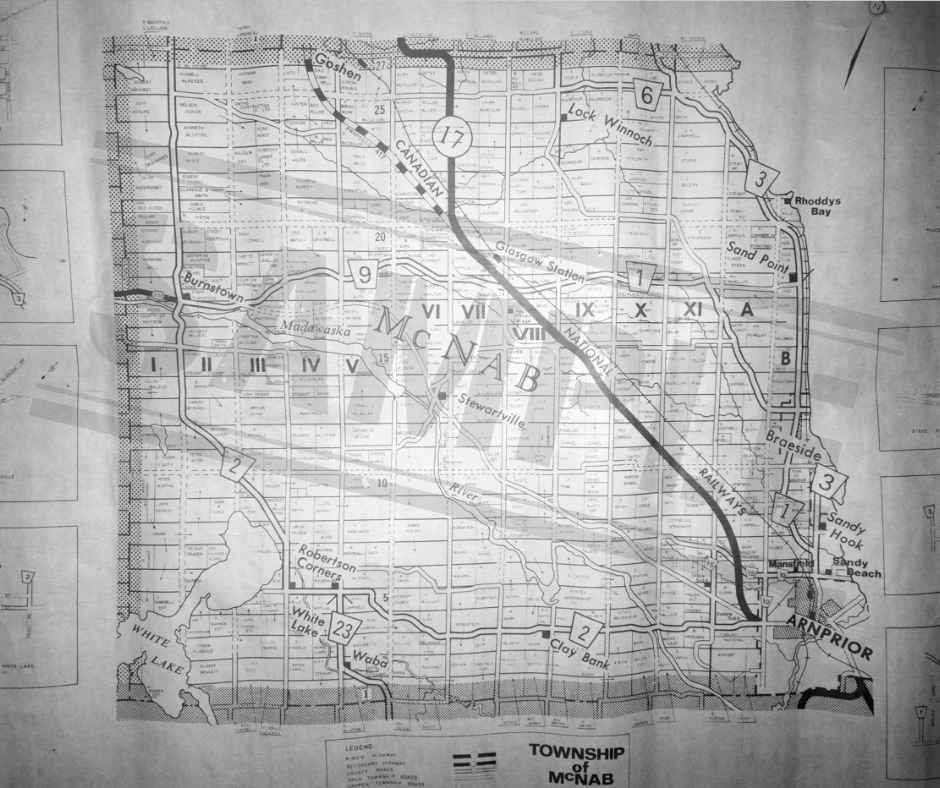
Map 4
c.1963? – McNab Landowners
This is one of four ‘mystery’ maps of McNab landowners in the archives. Maybe you can help us to solve their mysteries – please see the AMBA’s Mystery Maps poster.
Map 4 is undated, but no earlier than 1960. It was drawn by “MJF” and depicts the railways accurately. Hwy 17 goes through Arnprior. “Lock Winnoch” is in the northwest corner.
|
|
Map 5
c.1970? – McNab Landowners
The original Map 5 is somewhat wrinkled, making roads look curvier than they are. But it adds street plans for many hamlets in the margins, and it has a legend. It is undated, but before 1974. The map itself is new, with more labeled places and different border shading. A proposed rerouting of Hwy 17 near Glasgow is shown. But Map 5 introduces a rail spur that had been removed in the early 1950’s, that once ran from the CNR in Mansfield to the airport. It, too, has “Lock Winnoch” where Lochwinnnoch should be.
|
|
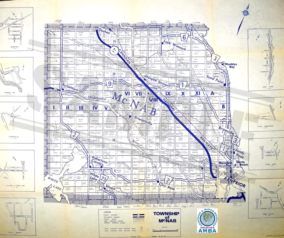
Map 6
1979 – McNab Landowners
Map 6 – clearly an update of Map 5 – is the only landowners map with a date. In fact, it has two; updated in 1974 and again in 1979. The rerouting of Hwy 17 in the northwest is complete. Since the Arnprior hydro dam and Hwy 17 bypass are not shown, it seems that only landowner names were, in fact, updated after 1974.
|
|
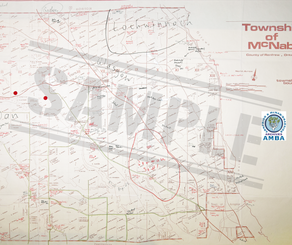
Map 7
c. 1985? – McNab Landowners
Map 7 was used by Peter Hessel when working on McNab – The Township (1988). Newly drawn, it has the dam, head pond and Hwy 17 bypass at Arnprior, but its railways are a fantasy. The marginal street plans are gone, and lot lines are faint or missing.
|
Limited Edition Cooler Bags
Cost: $33+ HST
Where to buy:
Township Office (2473 Russett Drive) Accepting Cash and Debit
Limited quantities available, so be sure to stop by and get yours while supplies last!
